Uncategorized
FMVPro Widget: ESRI WebApp Builder Integration with FMV Server
The use of the drones in military and commercial applications has increased drastically in recent years. Drone captured video can be easily converted into Full Motion Video or FMV where GIS information is infused/multiplexed into single file. FMV Server can store these videos into single location and the user can easily view and search them through an internet browser. FMV Server also has extensive API which gives ability to integrate with other platforms.
In this article we will describe the FMV Server integration with a very popular GIS platform – Web App Builder by ESRI. WAB is distributed through cloud solution ArcGIS Online or can be used locally through Portal for ArcGIS distribution as well.
We have built FMV widget which can be plugged into WAB applications for the user to view FMV videos stored on the FMV Server. This integration allows the user to view FMV videos and other GIS information in a single application as a Common Operation Picture (COP) perspective.
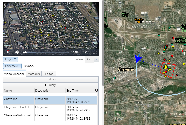
FMV Widget has many capabilities and can be easily extended. In figure one, a video is played back on the left. Associated GIS metadata is represented by an airplane and the field of view information of the camera. Point information is pulled from ESRI map service and is rendered on both the map and video player.
Figure 1. FMV video playback in WAB.
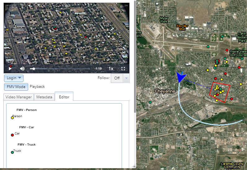
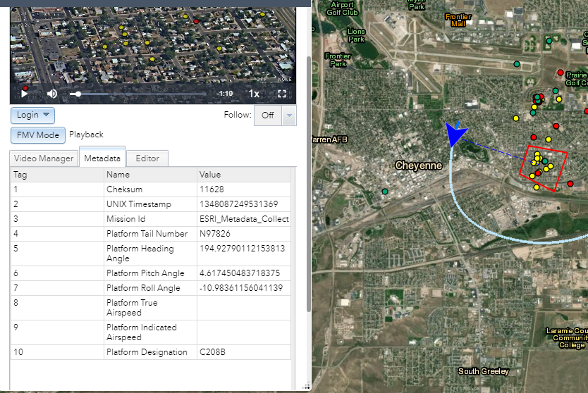
One of the key functionalities of the FMV is that each video frame has GIS information associated with it. In figure 2, the user has the ability to pick appropriate GIS feature template from the template picker. Then digitize features in the video and record that information into ESRI GIS platform which is immediately rendered on the map. The user can also do the reverse, digitize features on the map and render it on the video. Other FMV widget capabilities include the ability to measure object in the video, identify object and view metadata (Figure 3).
Figure 2. FMV widget feature editing and extraction.
Figure 3. FMV widget metadata playback.


